Advanced 3D subsurface characterization
3D magnetotelluric inversion for geophysical contractors and exploration teams in minerals, groundwater and geothermal.
We are opening pilot projects with companies and contractors that have MT data.
Why 3D MT
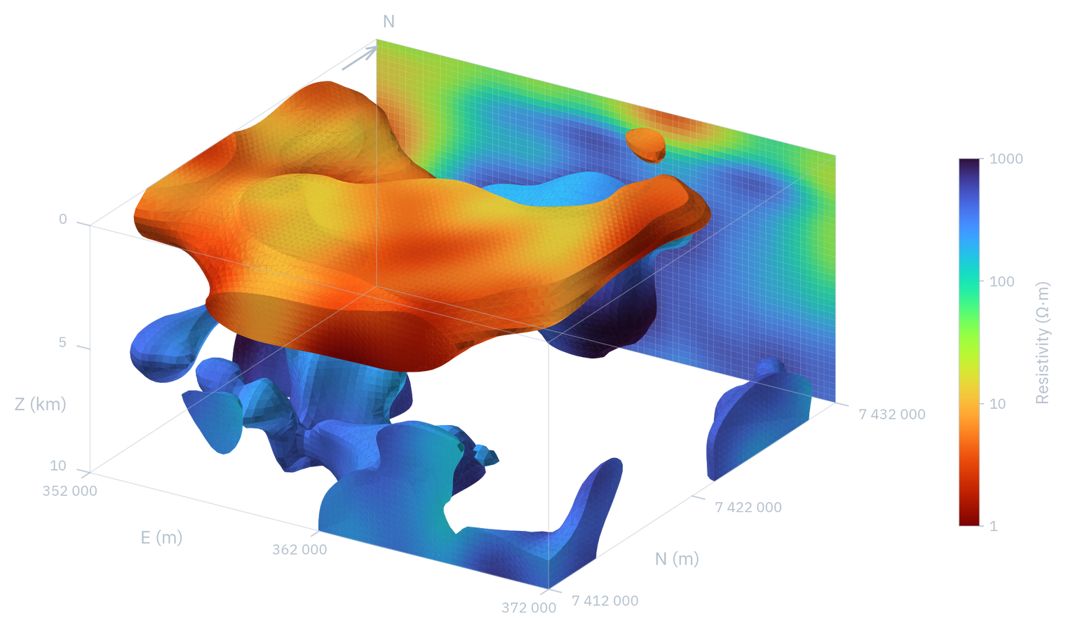
Magnetotellurics (MT) uses natural variations of the Earth’s electromagnetic field to map the electrical resistivity of the subsurface, from a few hundred meters to tens of kilometers deep. From those data we build a 3D resistivity model that supports geological interpretation and exploration planning.
Applications:
Mineral exploration
Deep mineral systems: porphyries, epithermal and IOCG deposits, and lithium brines.
Groundwater
Hydrogeological studies when the geology of the area justifies a 3D model.
Geothermal
Characterization of geothermal systems and reservoirs.
What we do
- 3D inversion of magnetotelluric data already acquired by the client or its contractor.
- 3D resistivity model, visualizations and a final report, at a technical level suited to the needs of the client and its team.
- Joint review of the results with your team.
- Consulting on MT data quality and use.
For geophysical contractors
We receive the MT data acquired and processed by your team and take care of the 3D inversion. As a result, we deliver the resistivity model, its visualizations and a technical report ready to integrate into your report to the client.
Book a callWe are looking for companies to pilot our technology
Our technology is under development (TRL 5) and has been validated with published data. We are looking for companies and contractors with MT data to pilot it on real projects and co-develop the final solution with us.
How to get started
Discovery call
Goal, available data, scope and timelines.
Data review
QC of the MT data.
3D inversion
Modeling carried out by our team.
Delivery and review
3D model, visualizations and final report.
Before the discovery call
More FAQsWhat data do you need?
Processed MT data and station locations. In the discovery call we check whether they are suitable for a 3D inversion.
Do you work with geophysical contractors?
Yes. We receive the MT data acquired and processed by the contractor, take care of the 3D inversion and deliver a technical report ready to integrate into its report.
What is delivered?
The 3D resistivity model, visualizations of the resulting model and a final report. We adapt the technical level of the report to the needs of the client and its team.
What is model uncertainty and why does it matter?
Every subsurface model has parts that are better supported by the data than others. Uncertainty tells you how much to trust each anomaly found: which ones are robust and which could change with more information. This helps prioritize targets and decide with more confidence where to drill or acquire new data. Our models include a confidence measure for each anomaly, and the way it is presented is adapted to what your team needs.

Have a geophysical challenge?
Let’s talk about your project in a discovery call. Contact: info@tsgeophysics.cl.
Book a callNews
See all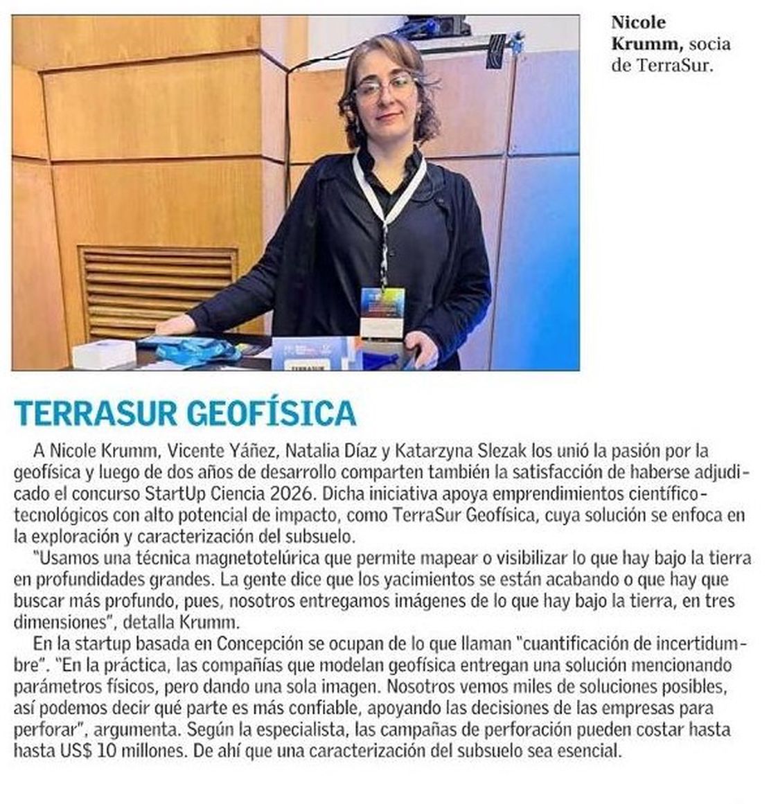
September 24, 2026
TerraSur Geofísica in the media
On Thursday, September 24, El Mercurio’s Innovation section dedicated its front page to five Chilean startups working to boost mining productivity, and TerraSur Geofísica was one of them.
Read More
June 23, 2026
Start Up Ciencia 2026 & OpenStartup G7
TerraSur Secures StartUp Ciencia 2026 and Joins OpenBeauchef’s OpenStartups G7 Cohort! June has been packed with big news:
Read More